Mapping the Town of Salem in 1814

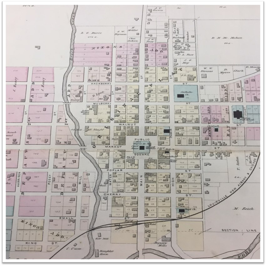
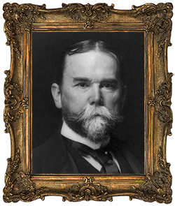
When General John C. DePauw and his able assistants laid out the town of Salem in 1814, they adopted as the names of the principal north and south and east and west streets which extended to all points of the compass from the court square, Main Street and Market Street.
North and South, Main Street was soon to become the principal thoroughfare not only of Salem but of south central Indiana, for year-after-year added population made it a thriving town, where taverns and stabling for horses “afforded food and shelter for man and beast.”
Market Street, running east and west, probably was intended to become “the market” of the town, while High Street, the main street east of Main, reached the highest part of the new town on the north. Water Street was probably named as was witnessed by the depth of Brock Creek which overflowed it at regular spring freshets, reaching over four feet in the famous 1913 flood.
When the town was being surveyed by General DePauw and Marston G. Clarke, who was a surveyor and engineer, huge oak, poplar, walnut and maple trees stood on the public square, four and five feet in diameter, covered with the immense grapevines, some of which were chopped to required length and used as chain by the surveyors.
Thus is easy to see why beginning near the south corporation near the present site of the depot, they began naming streets for the trees that abounded. Cherry, Poplar, Walnut, Mulberry and Hackberry formed the principal east and west streets besides Market and the narrow street on the extreme south boundary which was approximately named “Small.”
Later to add to the tree family, a street in northeast Salem was called Locust, because of the large number of small locust sprouts that grew up in the Rhetts addition.
College Avenue owes its name to the seminary that flourished on one side of it on Hackberry, and the Eikosi Academy just across its 24 feet span. Hays Avenue, on which the grade school fronts, was so named for Dr. Charles Hay, who laid out the addition it serves, and it is fitting that in this manner the name of an illustrious citizen, doctor and editor is preserved.
Judge Alspaugh laid out an addition to the town between Main and water near the north limits and the cross street he named Homer in honor of his eldest son.
The business of naming streets after members of the family or neighbors is well illustrated by the names of streets in the R. C. Morris three additions on the south side of Blue River, for we find the names of Lee and Arthur, for his two sons; Caleb, for his father; Carr, in memory of his mother’s maiden name, and Paynter, his wife’s maiden name. Because of his friendship with Judge J. L. Tucker, the principal street of the Morris Addition is Tucker Street.
Salem’s first mayor, Joseph W. Mayfield will be remembered by the street named after him-Joseph Street, running from the sewage disposal plant to Highway 135. This street was built under Mayor Mayfield’s administration.
Crossing Brock Creek, where DePauw’s second and third additions were mostly located, names of men prominent in history began to appear-Posey, Harrison, Shelby being three main north and south streets of west Salem, Mill Street that crosses and follows along Brock Creek were doubtless so named because of the grist mills located on its banks-and later to make it unanimous, saw mills, cabinet and planning mills, the furniture and chair factories, and others.
Two additions, laid out by James F. Persise, had streets honoring Franklin Lockwood, his wife’s maiden names; Lee named for his son, and Hazel. Then there was the principal street, Spring Grove, which adds its euphonious name to the rest of the list.
Out in “Tucker Town” as the Tucker addition is known, are streets honoring his sister, Mrs. Elizabeth Cauble; Bristol Street, named for Edgar H. Bristol; Mitchell, his wife’s maiden name; Berkey, Houston and Spurgeon-all good old Salem families.
Reid Avenue marks the place of the V.T. Reid homestead, and near it runs Emma Street, recalling Mrs. Emma L. R. Elliott, whose home it bordered. Only two streets are numbers, First and Third, both south of the Monon Railroad, where the plant of Link Handle Company is located.


